
Assessing Whether Indoor Navigation Is Needed
Indoor navigation is not a universal solution. Before committing budget and staff time, work through whether the problem you are trying to solve actually requires real-time positioning, or whether simpler wayfinding methods would do the job.
Start with the visitor's task. If someone needs to find a specific department in a large retail store, a single well-placed sign or a static floorplan on a wall may remove the confusion entirely. Indoor navigation earns its place when routes are complex, change frequently, or need to adapt to the individual — for example, directing a visitor to a specific gate in an airport terminal, guiding a delegate between sessions at a multi-venue conference, or providing step-free routes in a hospital.
Practical indicators that indoor navigation is worth investigating:
- Visitors regularly ask staff for directions to the same destinations.
- The venue has multiple floors, non-obvious corridors, or buildings connected by walkways.
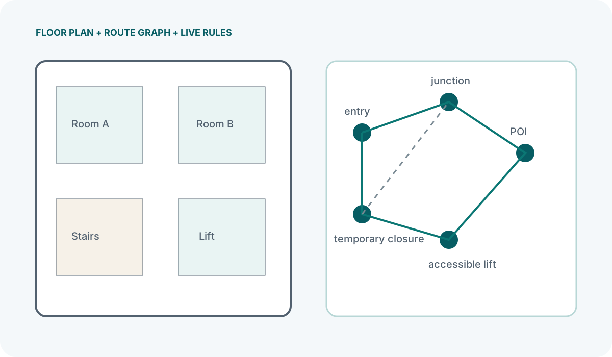
- Routes change at short notice — temporary closures, event-specific layouts, or relocated services.
- You need to deliver different routes to different people, such as accessibility paths or VIP access.
- Analytics on footfall flow and dwell time would inform operational decisions.
Equally, there are clear situations where indoor navigation is likely the wrong tool. Small venues with simple layouts, sites where visitors rarely return, or environments where phone use is restricted all point towards static signage or human stewards as the better first investment.
A useful test is to walk the venue as a first-time visitor with a specific destination in mind. Note every point where you hesitate or take a wrong turn. If those moments are few, the case for a full positioning system weakens considerably.
Defining Navigation Requirements
Once the need is established, the next step is to write down exactly what the system must do. Vague briefs such as "help people find their way" lead to scope creep and mismatched technology choices.
Who is navigating?
Different user groups have different constraints. A regular commuter in a railway station can learn a route after a few visits and may only need help during disruptions. A first-time visitor to a hospital outpatient department needs clear, step-by-step guidance with no prior knowledge. Event delegates move in large groups at predictable times, whereas museum visitors wander individually at varying paces. Each pattern affects the positioning method, the interface design, and the infrastructure density.
What are the destinations?
List every point the system must be able to direct someone towards. In a retail environment, that might be departments, tills, lifts and toilets. In a conference venue, it includes session rooms, catering areas, registration and exits. The granularity of destinations directly affects how many positioning reference points you need and how precisely the system must locate the user.
What does the user see?
Indoor navigation can be delivered through a native app, a mobile web page, or fixed kiosks. Each has trade-offs. A native app can run positioning calculations on-device and respond quickly, but requires the visitor to download something. A web-based approach lowers the barrier to entry but may face browser restrictions on background scanning. Kiosks remove the need for the visitor to use their phone at all, but only help at the point where the kiosk sits. The choice of interface constrains which positioning technologies are practical.
What are the operational constraints?
Consider whether the venue operates 24 hours, whether certain areas are off-limits to contractors, and who will maintain the system day to day. If the operations team has no in-house technical capacity, the solution must either be simple enough to hand over or come with a support contract that covers updates, fault response and infrastructure changes.
Choosing Indoor Positioning Technology
Indoor navigation systems rely on a positioning layer — the method by which the system determines where the user is. No single technology dominates every use case, and most real-world deployments combine more than one method.
Bluetooth beacons
Beacons broadcast identifiers that a phone can detect and use to estimate distance. By detecting multiple beacons and comparing signal strengths, the system can triangulate an approximate position. Beacons are well suited to venues where you control the physical infrastructure, need reasonable accuracy without installing new cabling, and already have or plan to build an app. Their limitations include signal instability caused by human bodies, metal fixtures and overlapping transmissions, which means calibration and ongoing adjustment are non-negotiable.
Wi-Fi positioning
Existing Wi-Fi access points can be used for positioning by measuring signal strength from multiple access points. This avoids installing additional hardware but depends on a dense, well-distributed Wi-Fi network. Accuracy varies with access point placement and the number of visible networks. Wi-Fi positioning works best in environments like airports and shopping centres where a dense access point infrastructure already exists for connectivity.
QR codes and NFC tags
Placing QR codes or NFC tags at decision points allows the visitor to trigger a location update manually by scanning or tapping. This is not continuous positioning — the system only knows where the visitor is when they interact with a tag. For straightforward wayfinding along a defined route, this can be sufficient and avoids the complexity of beacon calibration. The trade-off is that the visitor must take an active step at each point, and missed scans create gaps in the route.
Sensor fusion
Most modern systems combine beacon or Wi-Fi signals with the phone's own sensors — accelerometer, gyroscope and compass — using dead reckoning to fill gaps between positioning fixes. This improves smoothness on the map but introduces drift over time, which must be corrected by periodic reference points such as beacon detections or tag scans.
When evaluating technologies, ask suppliers specifically how the system behaves in your venue's construction type, what happens when signals are partially blocked, and what the calibration process involves on-site. Avoid any pitch that offers a single accuracy figure without reference to your environment.
Setting Accuracy Expectations
Accuracy in indoor navigation is frequently misunderstood. A supplier's quoted figure, if provided at all, typically refers to a controlled test environment — an open room with minimal interference and a limited number of devices. Your venue will differ.
Several factors degrade accuracy in practice:
- Construction materials: Metal partitions, reinforced concrete and glass with metallic coatings all attenuate or reflect Bluetooth and Wi-Fi signals unpredictably.
- Human bodies: A crowded corridor changes the radio environment compared to the same corridor empty. Water absorbs 2.4 GHz signals, and a dense crowd can shift measured distances by a metre or more.
- Device variation: Different phone models have different Bluetooth radios and antenna positions. A reading taken on one handset does not reliably predict the reading on another.
- Beacon orientation and mounting: A beacon mounted on a metal pillar behaves differently from the same model mounted on a plasterboard wall, even at the same height and broadcast power.
Rather than chasing a single accuracy number, define what the navigation task actually requires. If the system needs to tell someone which corridor to take at a junction, the relevant question is whether the position estimate reliably places the user on the correct side of that junction — a less demanding requirement than guiding them to a specific shelf in a retail aisle.
The only reliable way to establish accuracy for your venue is an on-site survey. This involves placing reference points at known positions, taking signal readings with the devices your visitors will actually use, and comparing estimated positions against the true positions. Any supplier unwilling to conduct or support this process before committing to a figure is not giving you a basis for planning.
Budgeting for Indoor Navigation
Indoor navigation costs extend well beyond the price of hardware. A realistic budget must account for several distinct layers, each of which can be underestimated.
Site survey and mapping
Before any positioning infrastructure is installed, the venue must be mapped in a format the navigation platform can use. This is not simply importing an existing PDF floorplan. The map needs to define walkable areas, obstacles, level changes and coordinate systems aligned to the positioning layer. Depending on venue size and complexity, this work can represent a significant proportion of the initial outlay.
Positioning infrastructure
Beacons, access points, QR codes or NFC tags, plus any mounting hardware. The quantity depends on the required density, which in turn depends on the accuracy needs and the physical environment. A space with heavy signal obstruction needs more reference points than an open hall of the same floor area. Battery-powered beacons also carry an ongoing replacement cost that must be factored in from the start.
Software and integration
The positioning engine, the navigation interface, and any connection to existing systems such as event schedules or retail product databases. If you are building a native app, development and ongoing maintenance costs apply. If using a web-based approach, there may be platform licensing fees. Integration with back-end systems is frequently the line item that grows most during implementation.
Calibration and testing
Initial calibration is labour-intensive. Technicians must walk defined routes, collect signal data, and adjust parameters until the system performs acceptably. This is not a one-time task — any change to the physical environment, such as new shelving, relocated partitions or seasonal display structures, can necessitate recalibration.
Ongoing operations
Staff time for monitoring system health, replacing failed hardware, updating maps when the venue layout changes, and responding to visitor feedback. If the system is used for analytics, someone must interpret the data and feed findings back into operational decisions. A navigation system that is installed and then left unattended will degrade steadily.
When comparing quotes, check whether each supplier has included the same scope. One may quote hardware only, while another includes survey, calibration and a year of support. The only meaningful comparison is between fully scoped proposals that cover the same period and the same operational responsibilities.


